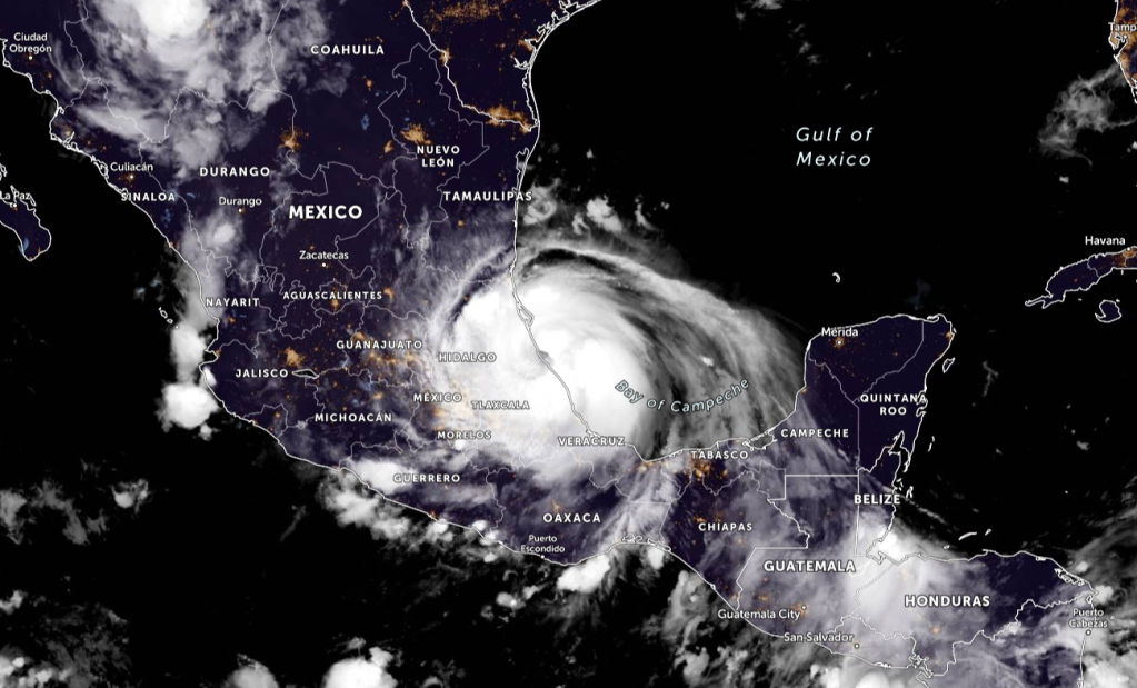
Satellite imagery and radar data from Mexico indicate that Grace has made landfall along the coast of Mexico near Tecolutla, Mexico, just prior to 100 AM CDT (0600 UTC). At 100 AM CDT (0600 UTC), the center of Hurricane Grace was located just inland near latitude 20.6 North, longitude 97.2 West. Grace is moving toward the west near 10 mph (17 km/h) and this general motion is expected to continue through this evening. On the forecast track, the center of Grace is forecast to farther inland over mainland Mexico today.
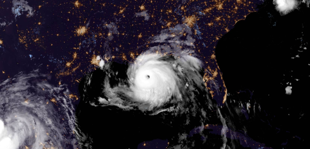
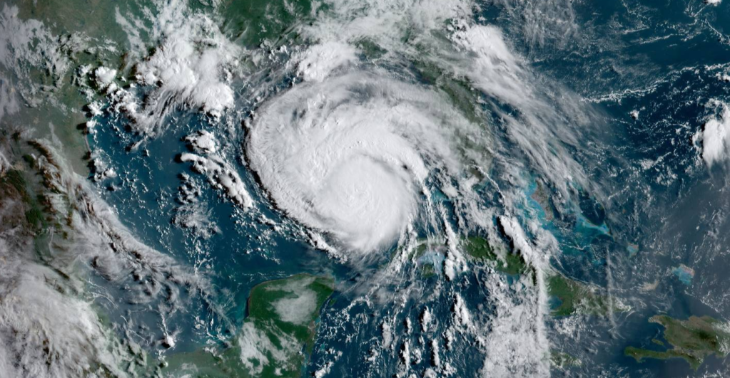
Maximum sustained winds have increased to near 125 mph (205 km/h) with higher gusts. Grace is a category 3 hurricane on the Saffir-Simpson Hurricane Wind Scale. Rapid weakening is expected as Grace moves inland over the mountains of central Mexico later today.
Hurricane-force winds extend outward up to 30 miles (45 km) from
the center and tropical-storm-force winds extend outward up to 150
miles (240 km).
The estimated minimum central pressure is 962 mb (28.41 inches).

WATCHES AND WARNINGS
CHANGES WITH THIS ADVISORY:
None.
SUMMARY OF WATCHES AND WARNINGS IN EFFECT:
A Hurricane Warning is in effect for…
- The coast of mainland Mexico from Puerto Veracruz to Cabo Rojo
A Tropical Storm Warning is in effect for…
- The coast of mainland Mexico from north of Cabo Rojo to Barra del
Tordo
A Hurricane Warning means that hurricane conditions are expected
somewhere within the warning area.
A Tropical Storm Warning means that tropical storm conditions are
expected somewhere withing the warning area.
For storm information specific to your area, please monitor products issued by your national meteorological service.
HAZARDS AFFECTING LAND
STORM SURGE: A dangerous storm surge will raise water levels by as
much as 6 to 9 ft above normal tide levels along the immediate coast
within the hurricane warning area near and north of where the center
is making landfall through early this morning. Near the coast, the
surge will be accompanied by large and destructive waves.
WIND: Hurricane conditions are expected to continue within portions
of the hurricane warning area in mainland Mexico through early this
morning. Tropical storm conditions are expected to continue within
the tropical storm warning area in mainland Mexico through this
morning.
RAINFALL: Grace is expected to produce the following rainfall
amounts:
Over Veracruz, Puebla, Tlaxcala, Hidalgo, Queretaro, and eastern San
Luis Potosi…6 to 12 inches of rain with isolated maximum totals of
18 inches are expected through Sunday. Heavy rainfall from Grace
will result in significant flash and urban flooding as well as
mudslides.
SURF: High surf generated by Grace will affect the southern Gulf of
Mexico coastline into the weekend. These swells are likely to cause
life-threatening surf and rip current conditions. Please consult
products from your local weather office.
Please be prepared for this storm. Stay updated with your local officials, and evacuate if needed. Stay tuned for more updates of this storm.
Information from the National Hurricane Center

Leave a comment