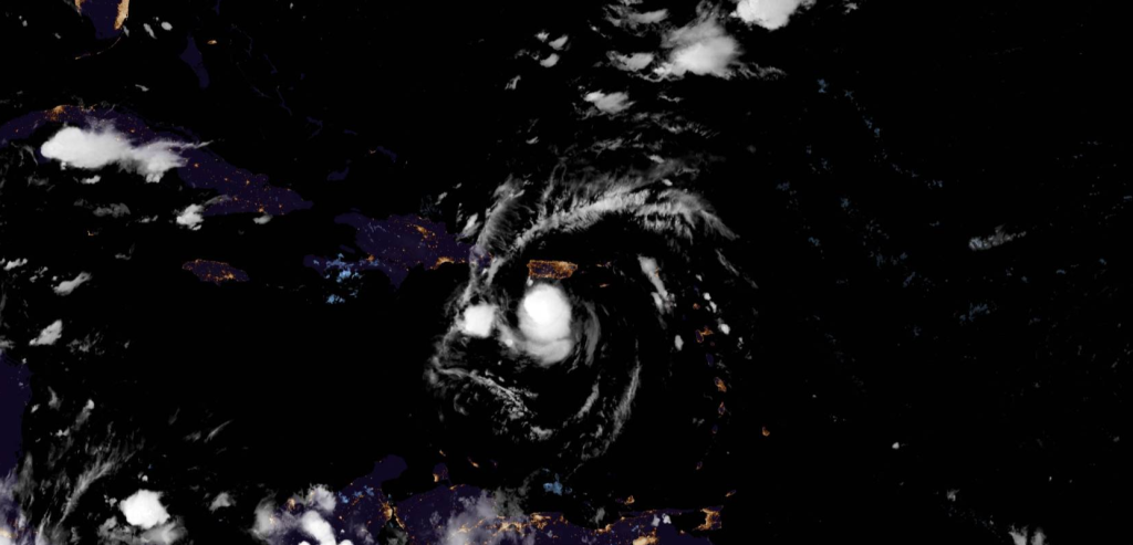
The National Hurricane Center has named Potential Tropical Cyclone 06L to Tropical Storm Fred in the Atlantic Ocean. Maximum sustained winds are near 40 mph (65 km/h) with higher gusts. Slight strengthening is forecast overnight before Fred reaches eastern Dominican Republic Wednesday morning. Some weakening is likely while the system interacts with Hispaniola on Wednesday. The estimated minimum central pressure is 1009 mb (29.80 inches).
Overview
Tropical storm conditions are expected in portions of the U.S. Virgin Islands and Puerto Rico tonight, and are expected to begin in the Dominican Republic Wednesday morning. Tropical storm conditions are possible in northern Haiti and the southeastern Bahamas by late Wednesday.
Heavy rainfall could lead to flash, urban, and small stream flooding, along with possible rapid river rises and the potential for mudslides across the U.S. Virgin Islands, Puerto Rico, and the Dominican Republic. The greatest threat for flooding impacts will be across eastern and southern Puerto Rico.
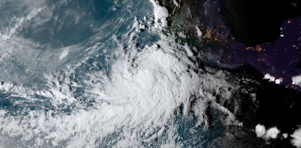
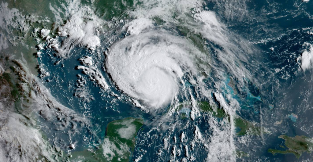
There is a risk of wind and rainfall impacts elsewhere in portions of Hispaniola, the Bahamas, and Cuba during the next several days, although the forecast is more uncertain than usual since Fred is forecast to interact with Hispaniola on Wednesday. Interests in these areas should monitor Fred’s progress and updates to the forecast.
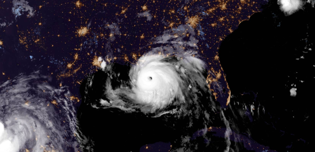
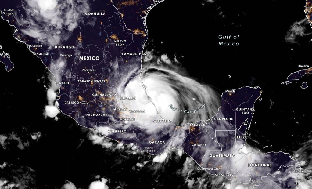
There is a risk of wind and rainfall impacts in Florida beginning Friday in the Keys and spreading northward through portions of the Peninsula and the Panhandle this weekend. However, it is too soon to determine the exact timing, location, and magnitude of any potential impacts. Interests throughout Florida should monitor Fred’s progress and check updates to the forecast.

FORECAST POSITIONS AND MAX WINDS
INIT 11/0300Z 17.4N 66.8W 35 KT 40 MPH
12H 11/1200Z 18.6N 68.9W 40 KT 45 MPH…INLAND
24H 12/0000Z 19.9N 71.4W 35 KT 40 MPH…INLAND
36H 12/1200Z 20.9N 73.7W 35 KT 40 MPH…OVER WATER
48H 13/0000Z 21.8N 76.0W 35 KT 40 MPH
60H 13/1200Z 22.8N 78.0W 35 KT 40 MPH
72H 14/0000Z 23.8N 79.9W 40 KT 45 MPH
96H 15/0000Z 26.5N 82.8W 45 KT 50 MPH
120H 16/0000Z 29.3N 84.6W 55 KT 65 MPH
RAINFALL: Fred is expected to produce the following rainfall
amounts:
Over the Leeward Islands, Virgin Islands, Puerto Rico, and the Dominican Republic…2 to 4 inches, with isolated maximum totals of 6 inches. Heavy rainfall could lead to flash, urban, and small stream flooding, along with possible rapid river rises and the potential for mudslides across the U.S. Virgin Islands, Puerto Rico,
and the Dominican Republic.
Over Haiti, the Turks and Caicos, eastern Bahamas, and eastern Cuba…1 to 3 inches with isolated maximum totals of 5 inches.
WIND: Tropical storm conditions are expected in the warning areas in the U.S. Virgin Islands and Puerto Rico during the next several hours, and in the warning area in the Dominican Republic by early Wednesday. Tropical storm conditions are possible elsewhere along the northern coasts of the Dominican Republic, northern Haiti, the Turks and Caicos, and the southeastern Bahamas beginning late Wednesday.
SURF: Swells generated by Tropical Storm Fred are affecting portions of the Leeward Islands. These swells are expected to spread across the U.S. Virgin Islands and Puerto Rico today and reach portions of Hispaniola on Wednesday, where they could cause life-threatening surf and rip current conditions. Please consult
products from your local weather office.
SUMMARY OF WATCHES AND WARNINGS IN EFFECT:
A Tropical Storm Warning is in effect for…
- Puerto Rico, including Culebra and Vieques
- U.S. Virgin Islands
- Dominican Republic on the south coast from Punta Palenque
eastward and on the north coast from Cabo Frances Viejo eastward
A Tropical Storm Watch is in effect for…
- Dominican Republic on the north coast from Cabo Frances Viejo to
the Dominican Republic/Haiti border - Haiti from the northern border with the Dominican Republic to
Gonaives - Turks and Caicos Islands
- Southeastern Bahamas
A Tropical Storm Warning means that tropical storm conditions are
expected somewhere within the warning area, in this case within the
next 12 hours.
A Tropical Storm Watch means that tropical storm conditions are
possible within the watch area.
Interests elsewhere in Haiti and the Bahamas, as well as in eastern
and central Cuba, should monitor the progress of this system.
For storm information specific to your area in the United States, including possible inland watches and warnings, please monitor products issued by your local National Weather Service forecast office. For storm information specific to your area outside of the United States, please monitor products issued by your national meteorological service.
Please be prepared for this storm. Stay updated with your local officials, and evacuate if needed. Stay tuned for more updates of this storm.
Information from the National Hurricane Center

Leave a comment