Potential Tropical Cyclone 06L has a high chance of formation in the Atlantic and is expected to become the next Atlantic tropical cyclone.
The system is forecast to become a tropical storm as it moves through the Leeward Islands tonight, and tropical storm conditions are possible there. Tropical storm conditions are expected in portions of the U.S. Virgin Islands and Puerto Rico beginning Tuesday afternoon, and in the Dominican Republic by Wednesday. Tropical storm conditions are possible in northern Haiti by late Wednesday.
Heavy rainfall could lead to flash, urban, and small stream flooding and potential mudslides across the U.S. Virgin Islands and Puerto Rico. The greatest threat for flooding impacts will be across the eastern and southeastern portions of Puerto Rico.
There is a risk of wind and rainfall impacts elsewhere in portions of Hispaniola, the Turks and Caicos, the southeastern Bahamas, and Cuba later this week, although the forecast is more uncertain than usual since the system is still in its formative stage. Interests in these areas should monitor the system’s progress and updates to the forecast.
Interests in the remainder of the Bahamas and Florida should monitor updates to the forecast for this system, but it is too soon to determine what if any impacts could occur there by late this week or this weekend given the uncertainty in the long-range forecast.

Current Information:
SUMMARY OF WATCHES AND WARNINGS IN EFFECT:
A Tropical Storm Warning is in effect for…
- Puerto Rico, including Culebra and Vieques
- U.S. Virgin Islands
- Dominican Republic on the south coast from Punta Palenque
eastward and on the north coast from Cabo Frances Viejo eastward
A Tropical Storm Watch is in effect for…
- Martinique and Guadeloupe
- Dominica
- Saba and St. Eustatius
- Dominican Republic on the north coast from Cabo Frances Viejo to
the Dominican Republic/Haiti border. - Haiti from the northern border with the Dominican Republic to
Gonaives
A Tropical Storm Warning means that tropical storm conditions are
expected somewhere within the warning area within 36 hours.
A Tropical Storm Watch means that tropical storm conditions are
possible within the watch area.
For storm information specific to your area, please monitor products issued by your national meteorological service.
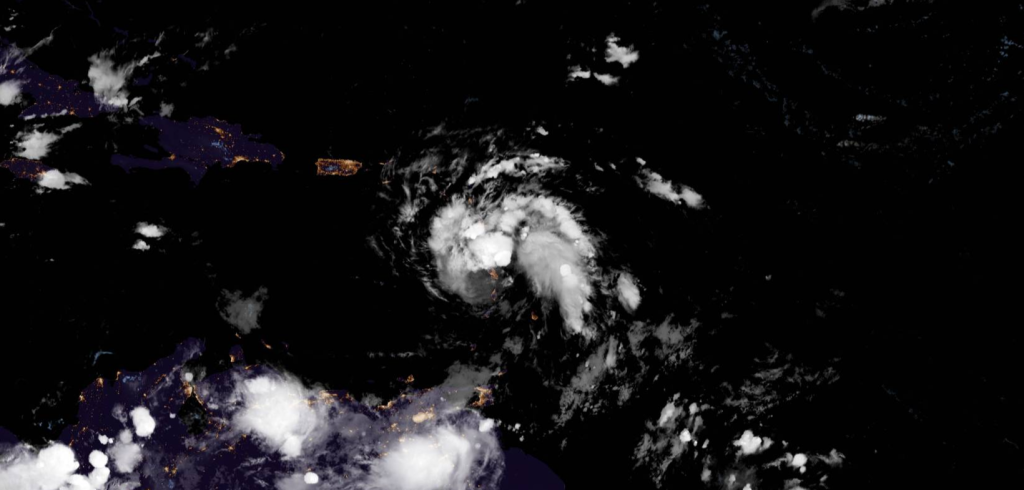
Overview
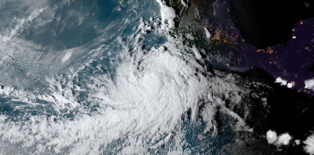
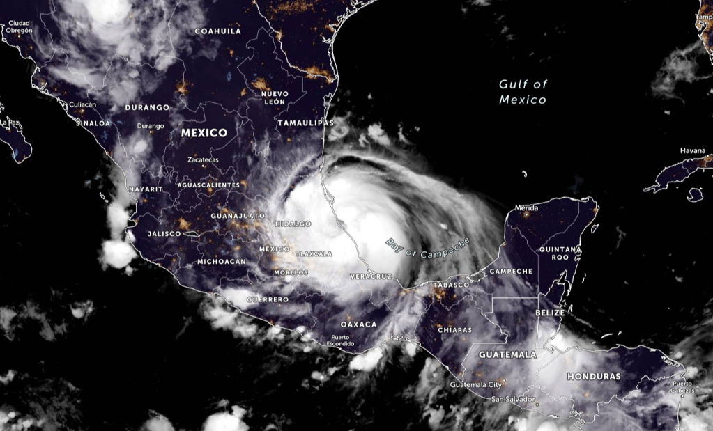
At 1100 PM AST (0300 UTC), the disturbance was centered near latitude 15.1 North, longitude 60.8 West. The system is moving toward the west-northwest near 16 mph (26 km/h) and this general motion is expected to continue during the next few days. On the forecast track, the disturbance is expected to move across the southern Leeward Islands during the next few hours, pass near or over the U.S. Virgin Islands and Puerto Rico late Tuesday and Tuesday night, and be near or over Hispaniola on Wednesday.
Maximum sustained winds remain near 35 mph (55 km/h) with higher
gusts. Gradual strengthening is forecast during the next day or two
and the disturbance is expected to become a tropical storm
overnight.
- Formation chance through 48 hours…high…90 percent.
- Formation chance through 5 days…high…90 percent.
The estimated minimum central pressure based on surface
observations is 1010 mb (29.83 inches).
Over the Leeward Islands, Virgin Islands, and Puerto Rico…2 to 4 inches, with isolated amounts of 6 inches. This rainfall could lead to flash, urban, and small stream flooding and potential mudslides across the U.S. Virgin Islands and Puerto Rico.
WIND: Tropical storm conditions are possible within the watch area in the Lesser Antilles overnight. Tropical storm conditions are expected in the warning areas in the U.S. Virgin Islands and Puerto Rico on Tuesday, and in the Dominican Republic by early Wednesday. Tropical storm conditions are possible elsewhere along the northern coasts of the Dominican Republic and northern Haiti beginning late Wednesday.
SURF: Swells generated by the disturbance are affecting portions of the Leeward Islands. These swells are expected to spread across the U.S. Virgin Islands and Puerto Rico on Tuesday and across portions
of Hispaniola on Wednesday, and they could cause life-threatening surf and rip current conditions. Please consult products from your local weather office.
Please be prepared for this storm. Stay updated with your local officials, and evacuate if needed. Stay tuned for more updates of this storm.
The next name in the Atlantic Naming list is Fred, Grace, and Henri.
Information from the National Hurricane Center

Leave a comment