
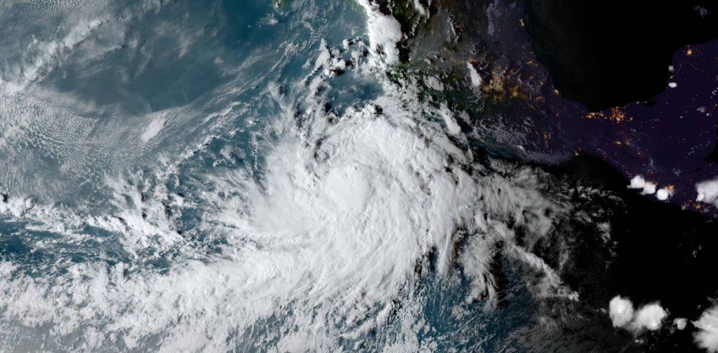
Typhoon In-Fa (Philippine Name Fabian) is now a high-end Category 2 Typhoon, interests in the Japanese Ryukyu Islands and Taiwan should be on high-alert for significant impacts in the coming days.


As of 01:00 UTC July 21, Typhoon In-fa (Fabian) is located near 24.1°N 127.8°E, about 144 nautical miles (265 km; 165 mi) south of Kadena Air Base, Japan. Maximum 10-minute sustained winds are at 70 knots (130 km/h; 80 mph) with gusts up to 100 knots (185 km/h; 115 mph), while maximum 1-minute sustained winds are at 95 knots (175 km/h; 110 mph). The minimum central barometric pressure is 970 hPa (28.64 inHg).
Forecast Discussion
The building subtropical ridge will steer In-Fa steadily to to the west-southwest over the next 2 days, until it weakens and retrogrades to along the continental coast. As it does so, it will allow the storm to lift to a more poleward track just as it is approaching the southernmost senkakus. The ridge over eastern China that is shooting the dry air into the system will weaken at about the same time and In-Fa will peak in intensity just as it begins to track north of west. As it moves into the northwesterly track, it will weaken slowly over the East China Sea until it makes landfall at or just below typhoon intensity. Model guidance has been consistent throughout the storms life cycle up to the 72 hour period, then scattering to as far south as a strike on Taipei (AFUM and EGRR) and as far north as the 28th latitude. The ECMWF ensemble has been steady and is consistent with consensus, while the GFS ensemble has shown a tremendous variability later. Based on the excellent performance of the mult-model consensus thus far, the JTWC forecast stays close to consensus throughout the forecast. Maximum significant wave height is 9.1 meters (30 feet).
Information provided by the Joint Typhoon Warning Center (JTWC).
Please be prepared for this storm. Stay updated with your local officials, and evacuate if needed. Stay tuned for more updates of this storm.

Leave a comment